KEYWORDS
AI, extraction, hyperspectral imaging, Google Earth, cubesat, space, anthropocene, post-anthropocene.
HYPERMINER_EXTRACTED EARTH
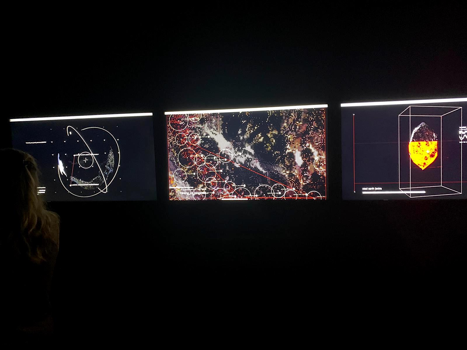
The project explores the HYPER EXTRACTION of natural and economically valuable resources using advanced mining acceleration technologies by the means of hyperspectral imaging, artificial intelligence and data-driven decision making. WHAT DO YOU SEE In the artwork we see how deposits are allocated, extracted (speculative) and used to create a new geode composed of the most valuable natural resources found on Earth. TRIPTYCH Screen one: a cubesat in orbit is scanning Earth for rare earth deposits. Screen two: valuable natural deposits are allocated by the means of machine learning, hyperspectral imaging and detection. Valuable natural elements like rare earth metals are mined. Screen three: rare earth elements are used to create a geode (extracted earth).
PROJECT CONTEXTUALISATION
Hyperspecral data from CUBESATs equipped with machine vision in outer space are used to allocate deposits and natural resources on Earth with unprecedented accuracy and vision. As major discoveries of near-surface mineral deposits are declining globally, new methods are needed to detect economical deposits at great depths. However, this is challenging due to the relatively small size of ore deposits, the limited number of existing geological data at depth, and limitations of the geophysical methods used for their detection. Machine learning can aid in developing better models for the prediction of rock type and economical mineral deposit locations for extraction purposes without engaging in time and resource-intensive approaches.
GENERAL CONTEXTUALISATION
The need for monitoring environmental dynamics is now even more urgent given the acknowledged impact of climate change, sustainable food sources, and intensified need for green energy. Different visualisation tools exist for geospatial data, however, these are not suited to capture the complexity of hyperspectral imagery. This makes our project relevant, trans-sectoral and trans-disciplinary.
EXTRACTIVISM
Mass-scale development of digitalisation lead to a situation in which digital devices not only are a constant element of our existence and landscape but transformed us into functional hybrids of bodies welded with small boxes full of microchips. For smartphone production, in addition to aluminium, palladium, copper, or gold, there is a need for minerals of little telling names like cobalt, yttrium, lanthanum, or neodymium, whose extraction requires advanced technologies, which, consequently, carry many long-term ecological, social, and political ramifications.
Modern forms of extractivism involve not only the extraction of the planet, its resources, and the biosphere. They reach far out, beyond the Earth, embrace the cosmos and aim at other planets of the Solar System. For the first time in human history, extractivism reaches into a human as well, to their deepest desires, behaviours, and experiences. Extracting data from human life, and gathering traces of online activity – so-called behavioural surplus – has its analogies with colonial strategies. Data acquired simultaneously to the acceptance of “cookies” or terms of use, is, as a resource, processed, refined, and, eventually, divided into fractions – human desire transforms into attainable profit. This data, regarding current and future behaviours of particular individuals, is appraised and sold on the global market of Internet advertising. Serving surveillance capitalism, extractivism monetises deep knowledge of each entity and element of the ecosystem. Our every step on the Web is carefully monitored and painstakingly analysed. Unconsciously, we produce a brand-new type of knowledge, capitalised by great business, and also used for testing devices of collective control. – Ref. https://2022.biennalewarszawa.pl/en/ekstraktywizm/
TECHNICAL INFO
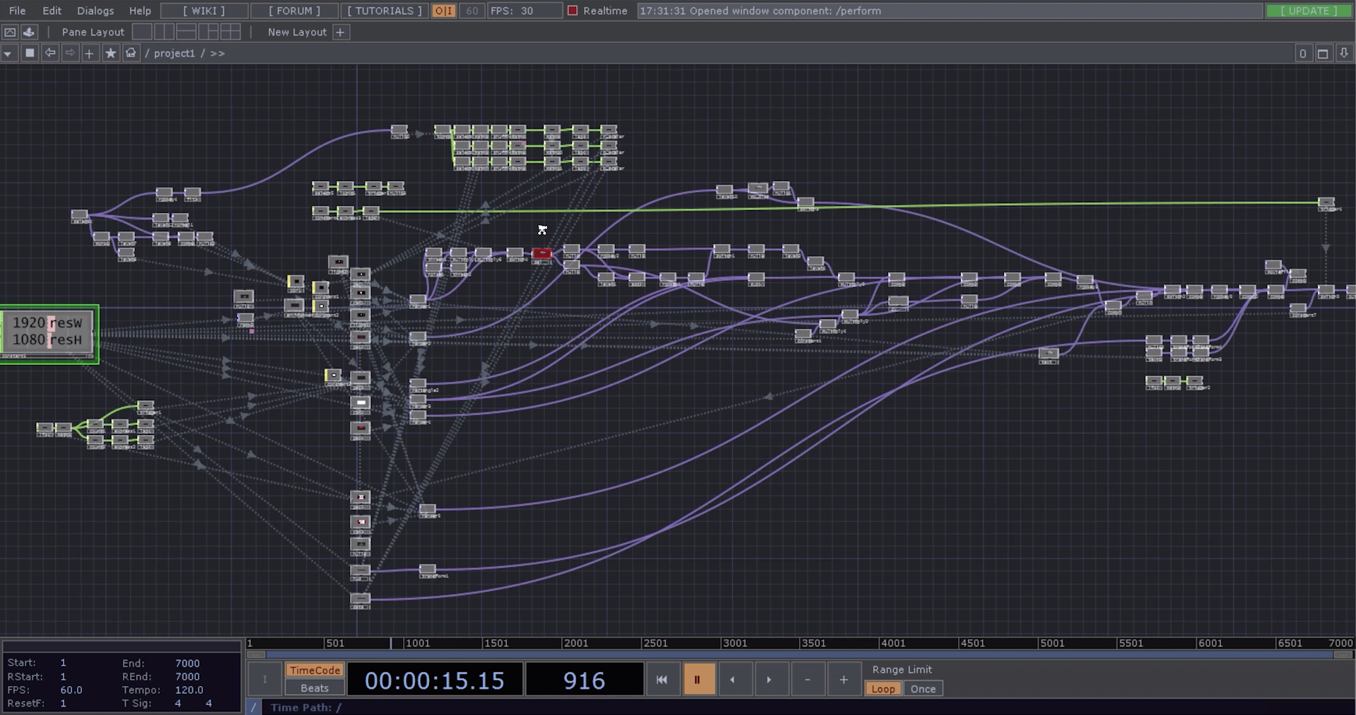
The audiovisual artwork is made in Touchdesigner. The installation can run realtime or presented as a video (2K/4K/8K). Realtime data from Google Earth is combined with hyperspectral images from satellites with embedded machine learning.
USEFUL INFO
We are currently discussing with a hyperspectral cubsat company the possibility to collaborate and elaborate on our current setup to track waste in the oceans.
CREDITS
The project was realised during the “Geographies of an AI” residency organised by the Onassis Stegi Foundation, 2020/21. Warm thanks to Daphe Dragona and Michelle Kasprzak for their valuable input. We also thank SCANWORLD for helping us out with hyperspectral data and images. We also would like to thank GOOGLE EARTH.
PRODUCTION
Studio De Wilde © all rights reserved – 2021 INQUIRIES studio.frederik.de.wilde@gmail.com


